Goochland Historical Society
Search this Website
« Go Back
1863 Gilmer Map
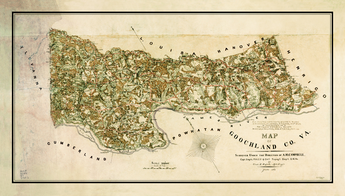
1863 Gilmer Map is a detailed map of Goochland County. It contains the names of landowners, churches, schools, gold mines, and other sites. Reproduced in full color on acid-free, heavy-weight paper from the collections of the Virginia Historical Society who gave the Goochland County Historical Society permission to print and sell this map. It measures 32 x 18 inches. Click here to view list of names and places appearing on the map.