Goochland Historical Society
Search this Website
« Go Back
1820 John Wood Map
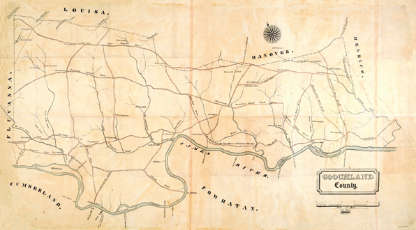
1820 Map by John Wood. This map is the earliest map of Goochland County. It was reproduced from the collections of The Library of Virginia. It shows the location of many taverns, ferries, and mills as well as roads that are no longer in use. Reporduced on acid-free, heavy-weight paper in full color. The map measures 32x20 inches.